These maps, included because of their relevance to essays, multimedia projects, and Mediterranean history, are organized chronologically from present to past. We chose to display multiple maps because, as our studies have revealed, there is no one map or frame that can fully represent the Mediterranean region. We chose maps of this ever-changing geography that depict some of the most significant border changes as well as display the region as a multicultural space.
Venice Biennale, 2019
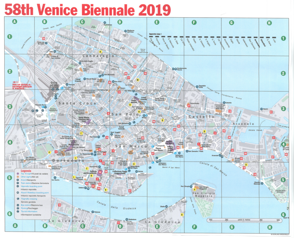
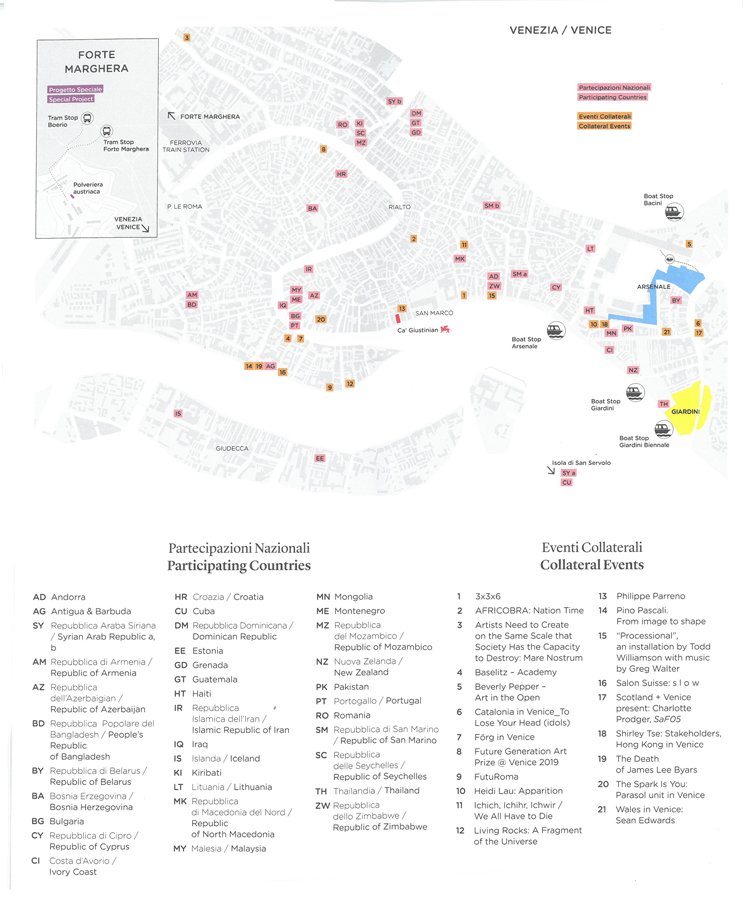
Source: NanQuick: Venice, BIENNALE ARTE 2019. Part One
Mediterranean Migration Crisis, 2014-2017
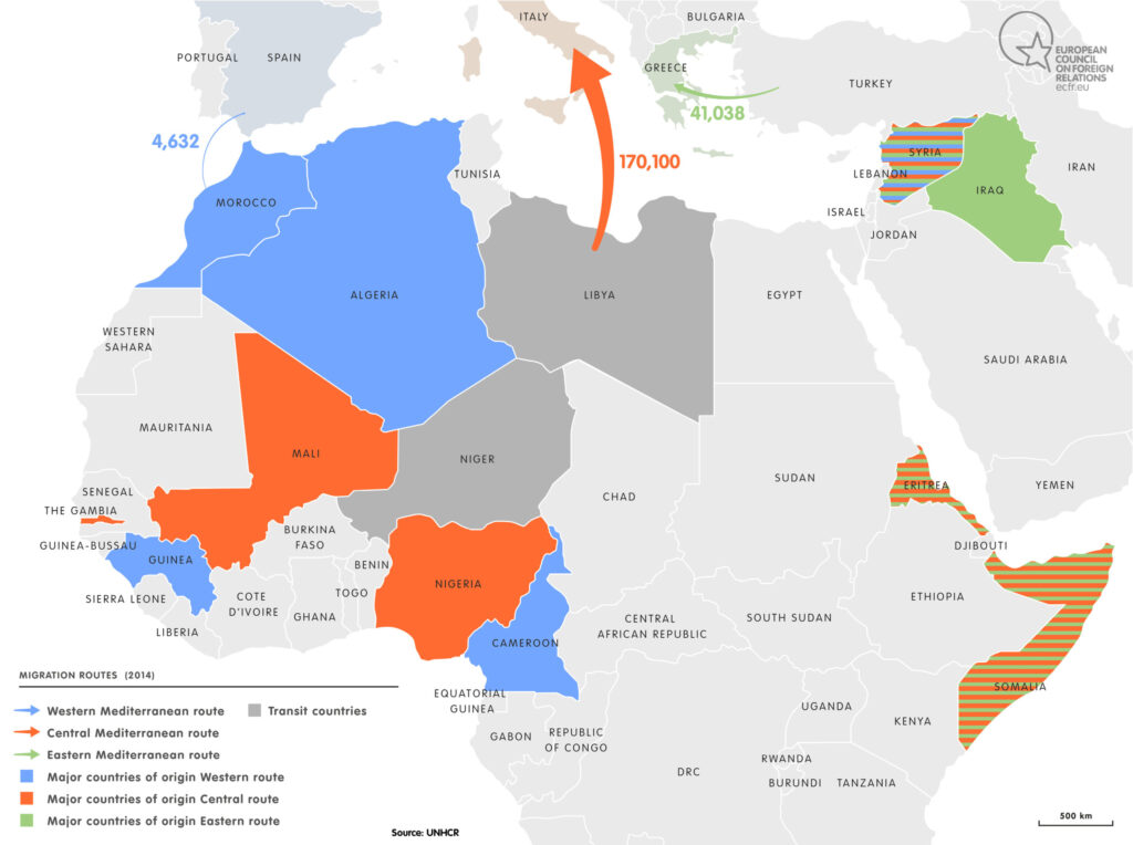
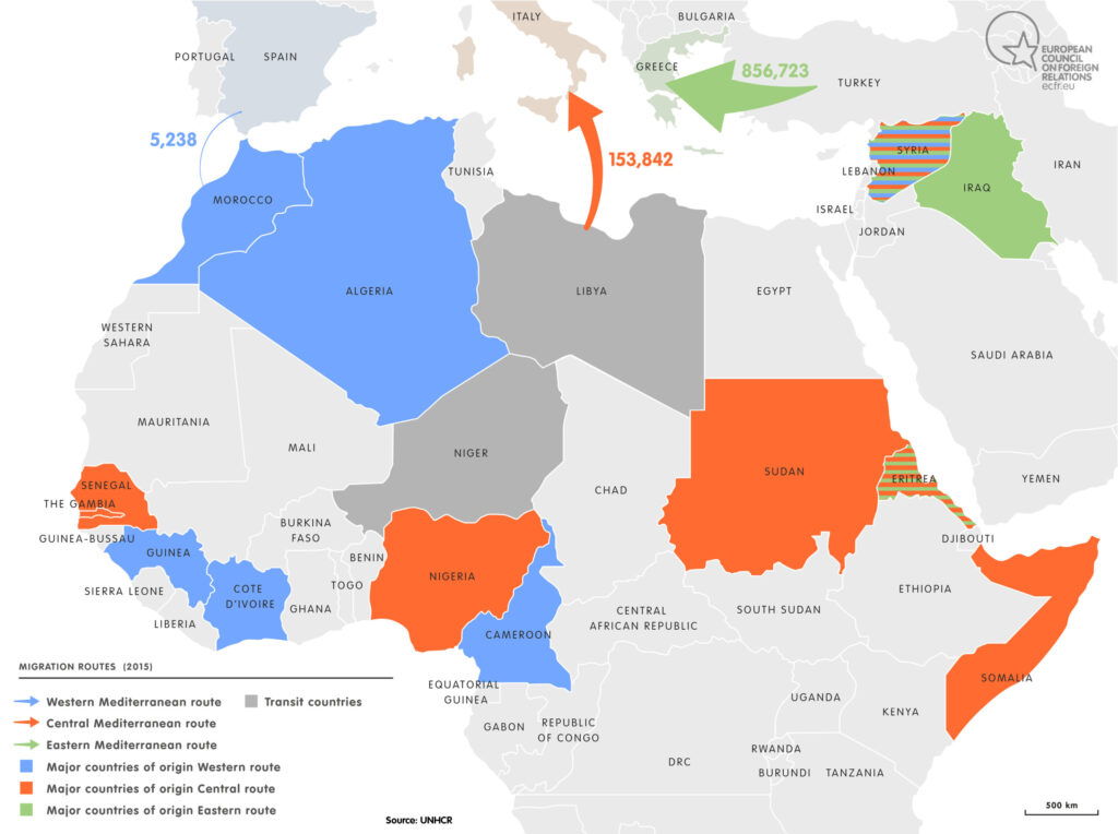
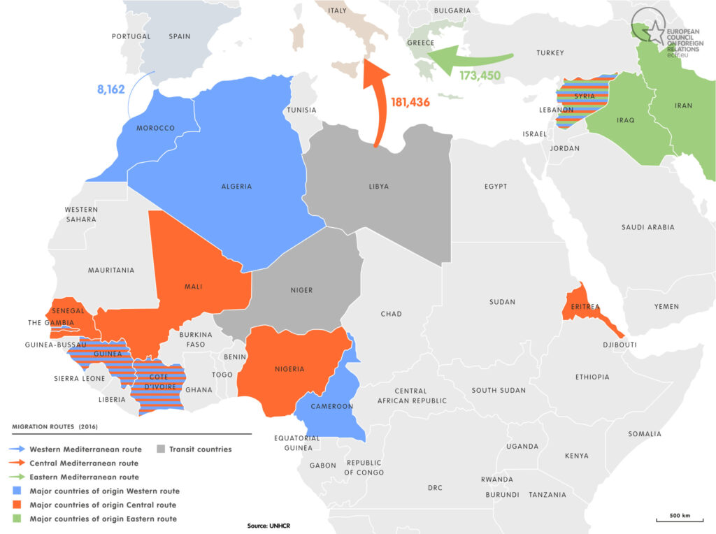
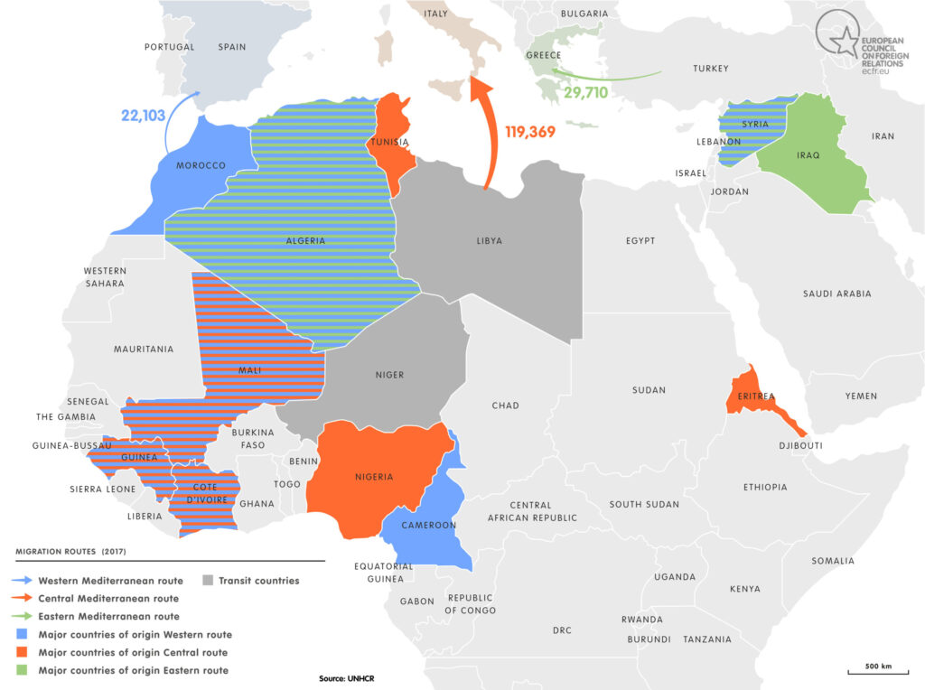
Eastern, central, and western Mediterranean migration routes and the major countries involved from 2014-2017, at the peak of the migration crisis.
Source: ECFR: Migration through the Mediterranean
“Mediterranean Without Borders,” Sabine Réthoré, 2011
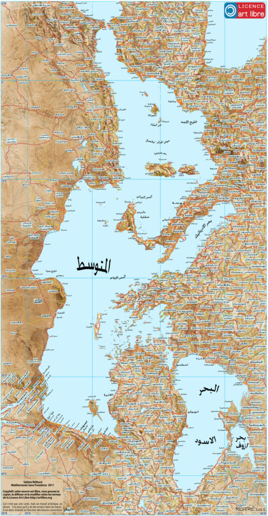
Map depicting the Mediterranean region turned sideways and without borders, annotated in Arabic. “Mediterranean Without Borders” Sabine Réthoré, 2011 (Arabic).
Source: “Mediterranean Without Borders” Sabine Réthoré, 2011
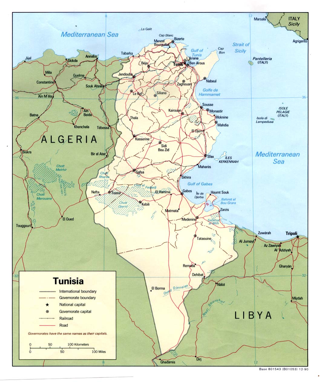
Tunisia, 1990
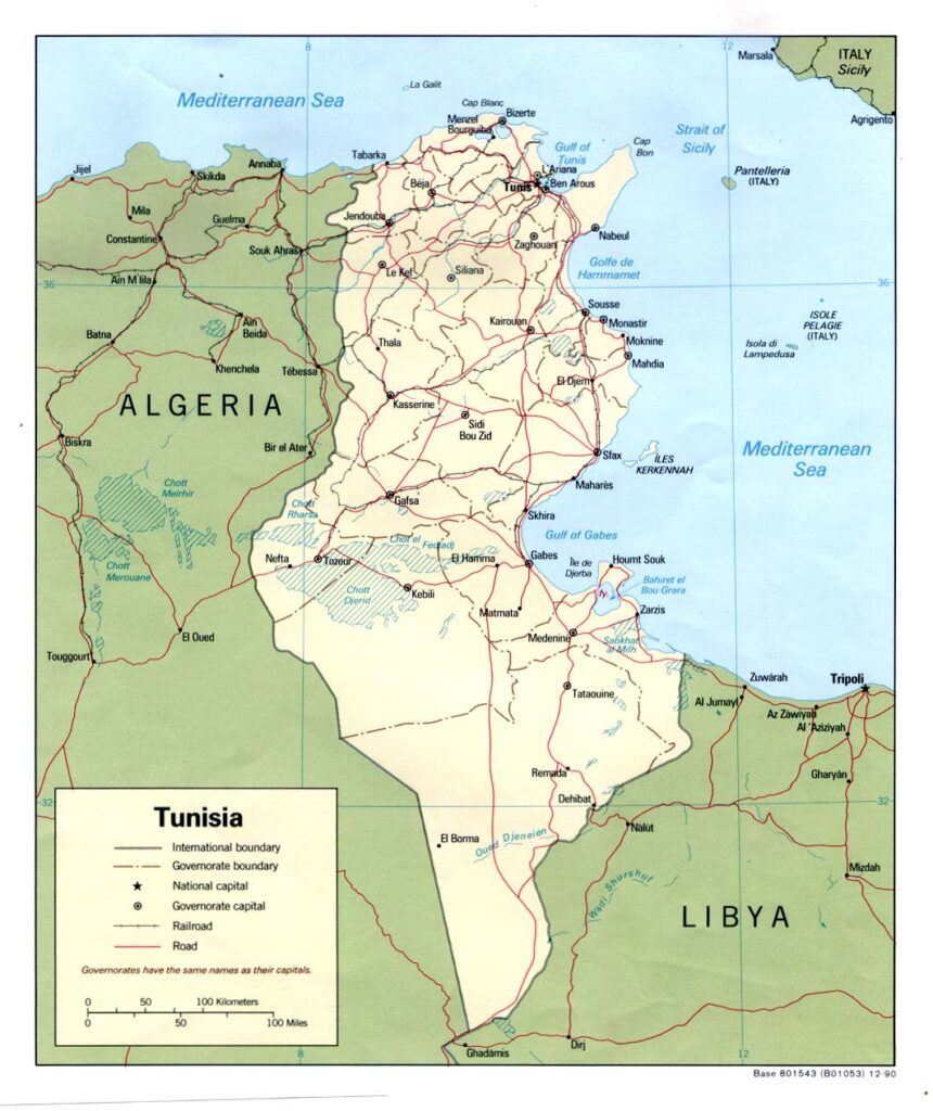
Political map of Tunisia in 1990, 34 years after the country finally reached independence in 1956.
Source: UTexas- Tunisia (Political) 1990
Europe after World War II, 1945
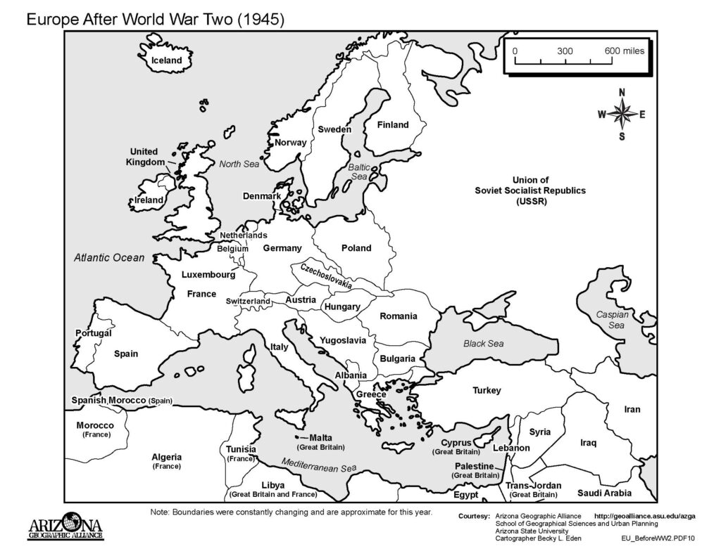
Source: Arizona Geographic Alliance: EU After WWII
Europe Before World War II, 1939
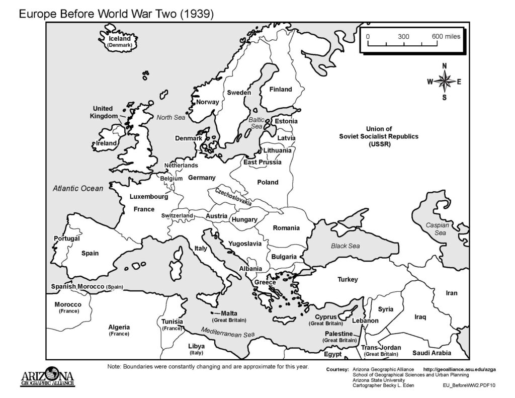
Source: Arizona Geographic Alliance: EU Before WWII
Ottoman Empire, 1807-1924
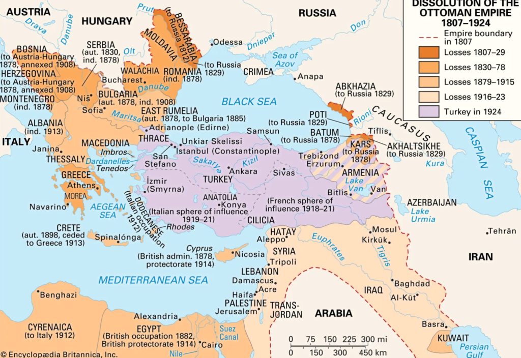
The fall of the Ottoman Empire, shown by dissolution of territory from 1807 to 1924.
Europe After World War I, 1918
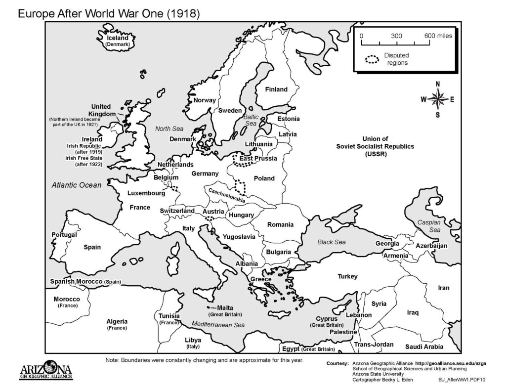
Source: Arizona Geographic Alliance: EU After WWI
Europe Before World War I, 1914
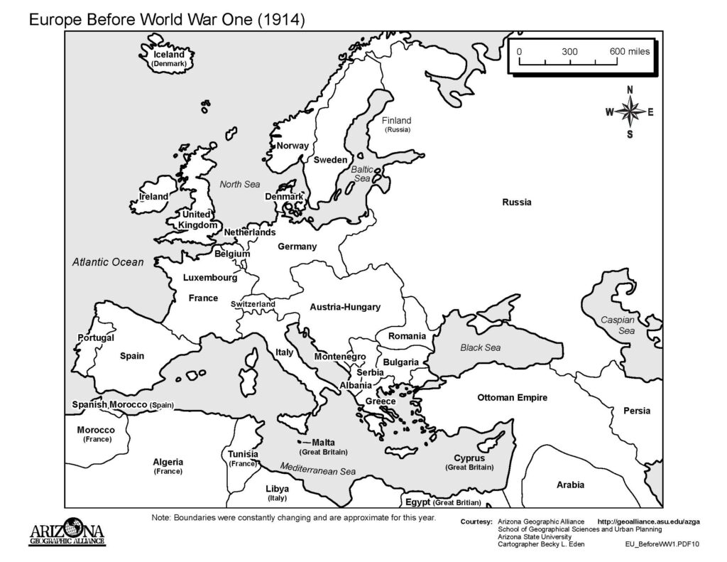
Source: Arizona Geographic Alliance: EU Before WWI
Sicilian Mafia, 1900
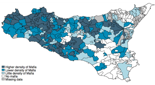
Mafia presence in Sicily municipalities in 1900.
Source: Weak states: Causes and consequences of the Sicilian Mafia
Sicilian Peasant Fasci, 1893
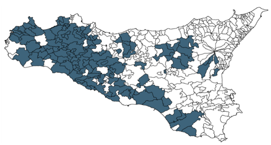
Peasant Fasci, the first major socialist organization in Italy, organization presence shown in gray on the island of Sicily in 1893.
Source: Weak states: Causes and consequences of the Sicilian Mafia
Tunisia, 1889
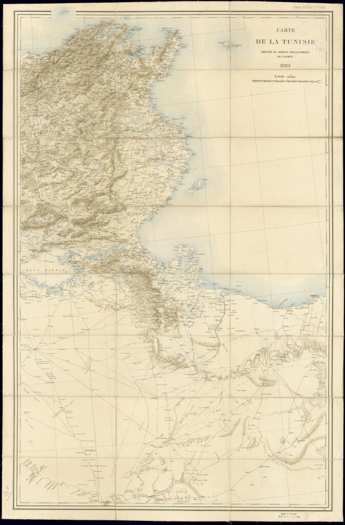
Cartographic map of Tunisia in 1889, eight years after French invasion in 1881. Service géographique de l’Armée, Paris.
Source: Carte de la Tunisie
Ottoman Empire, 1300-1700
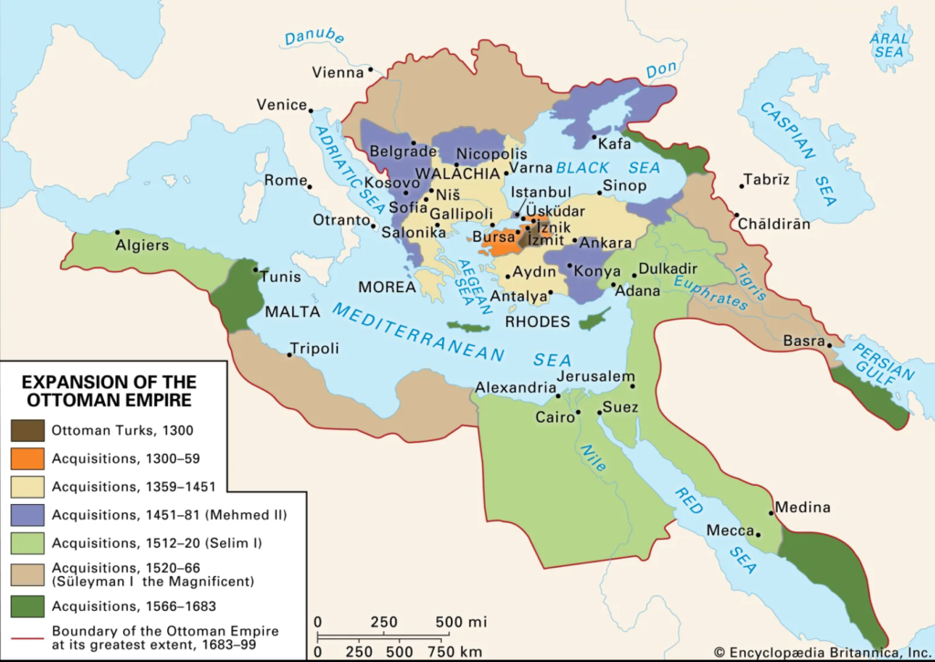
Ottoman Empire territory and expansions from 1300-1700.
Source: Brittanica: Ottoman Empire
Europa Regina, 1533
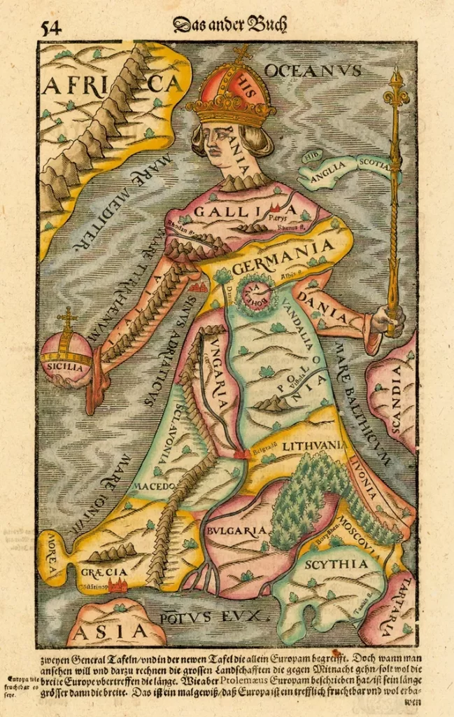
Johannes Putsch’s 1533 map depicts the continent as a queen, inspiring a movement of maps that depict people, animals, and plants.
Source: National Geographic: Europa Regina
Silo’s Apocalypse World Map, c. 1091-1109
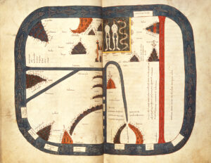
One of the earlier “world maps” created. The manuscript that this is part of was created as Islam spread over the Iberian Peninsula and was meant to depict how the apocalypse would come. Silos Apocalypse world map, 1091-1109, Manuscript, parchment on vellum, Beautus of Liébana, British Library, London.
Roman Empire, First Century A.D.
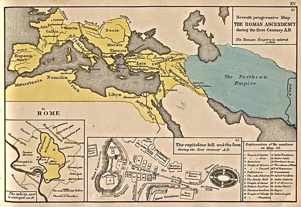
The Roman Empire in the first century A.D.
Source: “The Roman Ascendency during the first Century A.D.” from An Historical Atlas Containing a Chronological Series of One Hundred and Four Maps, at Successive Periods, from the Dawn of History to the Present Day by Robert H. Labberton, sixth edition, 1884.